Community Corner
More Snow … More Cold …
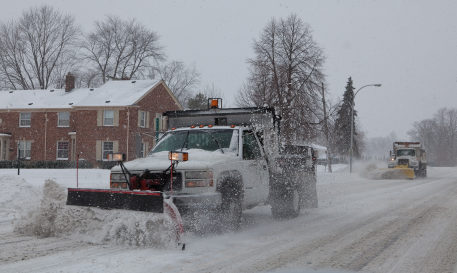
Between two to four inches of snow could fall in northern Illinois Saturday night and Sunday.

More snow and more cold is headed our way … again.
Late Saturday night and into Sunday morning, snow is expected to fall over northern Illinois and northwest Indiana leaving two to four inches of accumulation by Sunday afternoon, according to the National Weather Service.
A strong cold front will follow bringing gusty winds of up to 45 mph for a period Sunday evening, according to the NWS. Blowing and drifting snow is likely and could temporarily cause blizzard-like conditions with whiteouts possible.
A wind chill watch has been issued for much of the Chicago area from 3 a.m. Sunday through 9 a.m. Wednesday. Wind chill values could be 30 below zero or lower.
Get more local news delivered straight to your inbox. Sign up for free Patch newsletters and alerts.
We’ve removed the ability to reply as we work to make improvements. Learn more here